National Soils Inventory - NSI
NSI Site Information - NSI Site

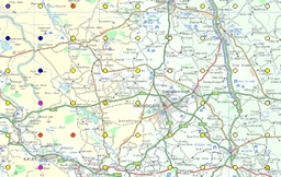
The National Soil Inventory (NSI) site data is a spatial, point dataset with 6,127 points, located in a 5km grid across England and Wales.
NSI Site provides a in depth description of the general land features at each of the NSI points across England and Wales.
NSI Site contains data on the land use, slope, slope form, human influence on the landscape, rock outcrops, the altitude, aspect, erosion and deposition features and a description of the rock type. As such, NSI Site gives a comprehensive description of the sites in which these inventory points were taken.
NSI Site has proved useful for those who would like to have a good picture of the landscape across these two countries, for instance in a project examining the link between erosional features and the amount of Carbon in the upper 15cm of soil.
How much does this product cost?
- £600 for each individual property across England and Wales;
- £10 per point, all data for that point (discounted for more than 50 points);
- £3,500 for the whole dataset.
For detailed pricing information, use our Quotation Advisor utility.
NSI Site data and description
The table below describes the various properties within this data product. Each point contains the information outlined below.
| Property | Example from data | Description |
|---|---|---|
| EAST_NSI | 396000 | National Grid reference easting at 5km resolution with 1km offset from true grid |
| NORTH_NSI | 216000 | National Grid reference northing at 5km resolution with 1km offset from true grid |
| EASTING | 396000 | National Grid reference easting of the actual location surveyed |
| NORTHING | 216100 | National Grid reference northing of the actual location surveyed |
| SURVEYDATE | 220182 | Date of observation |
| SERIES_NAME | DIDMARTON | The name of the soil series, the basic unit of soil taxonomic classification, named after the place where they were first described |
| VARIANT | Code to indicate that the profile is a variation of the defined soil series classification | |
| SUBGROUP | 5.14 | Number used to define a subgroup incorporating the major group, group and subgroup i.e.3.11, being the third level of soil taxonomic classification based on features which further define the inherent characteristics of the soil material |
| LANDUSE | Permanent grassland | Classification of Land use in to 17 classes |
| SLOPE | 2 | Slope in degrees |
| SLOPEFORM | straight | Slope form along the direction of the true slope (concave, straight or convex) |
| MADE_GROUND | Made land - Mining | Identification of sites which have been made or reclaimed by human influence |
| OUTCROP | Proportion of rock outcrops within 100m of the profile | |
| ALT | 750 | Altitude (m) above Ordnance Datum (OD) |
| ASPECT | SSE | Compass point (bearing code e.g. NNE) |
| EROSION | Classification of surface features formed by erosion of soil material | |
| DEPOSITION | Classification of surface features formed by the accumulation of soil material | |
| ROCKTYPE | Calcareous Oolitic limestone | Classification of rock based on recent Geological Survey and other modern publications |
