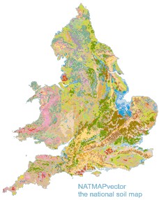
National Soil Map of England and Wales - NATMAP
NATMAP Vector
National Soil Map - Vector Data Version

NATMAP Vector is the principle soil data product held at Cranfield University. It is a 1:250,000 scale map of England and Wales, showing the locations of the 297 distinct soil associations wherever they occur within the countries. Within each of the soil associations are multiple soil series. This hierarchical data structure allows for easy integration with the the series-based, non-spatial SOILSERIES data, pulling this tabular data also in the the spatial framework.
Key Facts and Statistics about NATMAP vector
- 1:250,000 scale digitised National Soil map with 1:50,000 registered linework
- Coastal and inland water bodies registered to 1:50,000 scale
- Soil associations are the map units. Multiple soil series comprise a soil association
- 297 map units (Soil associations)
- Over 200 man-years went into the creation of this map product.
Who and what is this useful for?
- NATMAP vector is useful for anyone wanting detailed soil information at 1:250,000 scale.
- NATMAP vector is essential for the best resolution soil series based work for most of England and Wales.
- NATMAP vector is being used by most of the major water companies, many universities, consultants and governmental bodies. Because of the structure of NATMAP vector, it is readily customised with additional datasets, providing task-specific targeted information crucial to so many operations.
How much does this product cost?
- £500 per 1000km2.
- Significant discounts apply for larger areas.
For detailed pricing information, use our Quotation Advisor utility.
NATMAP Vector data and description
The table below describes the various properties within this data product. Each polygon contains the information outlined below.
| Property | Example from data | Description |
|---|---|---|
| LANDIS_NAT | 1266991.75 | Area of Polygon in square metres |
| PERIMETER | 4785.984 | Perimeter of Polygon |
| NATMAP_ | 4 | NATMAP ID number for Shapefile purposes |
| NATMAP_ID | 3 | NATMAP ID number for Shapefile purposes |
| MAP_SYMBOL | 541r | Map Symbol displayed on the map - combination of the unsurveyed flag with the map unit |
| MAP_UNIT | 0541r | National Soil Map Unit, Regional Bulletins and National Soil Map Legend. |
| UNSURVEYED | Unsurveyed if the area is urban, and the map unit has been derived external sources and expert udgement | |
| SHAPE | 2 | Feature ID code which links with the spatial description of the data within a geodatabase |
Additional NATMAP Datasets
The following two tables are provided FREE on leasing NATMAP Vector.
NATMAP Legend data (*FREE with NATMAP vector)
| Property | Example from data | Description |
| MAP_UNIT | 0311a | National Soil Map Unit, Regional Bulletins and National Soil Map Legend |
| MAP_UNIT_NAME | REVIDGE | Soil association name, named after the dominant soil series of which the association is comprised |
| SIMPLE_DESCRIPTION | shallow peat over sandstone | A simplified description of the soil association |
| SITE_GEOLOGY | Palaeozoic gritstone and sandstone | The geological parent material on which soil associations commonly occur |
| DOMINANT_SOIL | Very shallow very acid peaty upland soils over rock. | Text description of dominant soil type in soil association |
| ASSOCIATED_SOIL | Some thick peat. | Soil characteristics of associated soil |
| SITE_CHARACTERISTICS | Steep craggy ground with extensive bare rock and scree. | Text description of site characteristics of a soil association |
| CROP_LANDUSE | Stock rearing on wet moorland habitats of poor grazing value in the uplands. recreation | Text description of cropping and land use practices associated with a soil association |
| RED | 245 | RGB value for colour display (RED) |
| GREEN | 238 | RGB value for colour display (GREEN) |
| BLUE | 126 | RGB value for colour display (BLUE) |
NATMAP associations data (*FREE with NATMAP vector)
| Property | Example from data | Description |
| MAP_UNIT | 1024c | National Soil Map Unit, Regional Bulletins and National Soil Map Legend |
| DOMINANCE | 4 | Position of dominance of this soil series within this soil association (Map Unit) |
| SERIES | 2273 | Soil series code |
| SERIES_NAME | WITTERING | Soil series name |
| SERIES_PC | 10 | Percentage of this soil series in the soil association (Map Unit) |
