| Name | Last modified | Size | Description | |
|---|---|---|---|---|
| Parent Directory | - | |||
| soil_alerts_maps/ | 2024-07-11 14:54 | - | ||
| soil_alerts_logo/ | 2024-07-11 14:54 | - | ||
| series_photos/ | 2024-07-10 11:27 | - | ||
| Series_cropped/ | 2024-04-23 23:00 | - | ||
| Key/ | 2024-04-16 14:22 | - | ||
| Map/ | 2023-12-04 11:55 | - | ||
| Landscape/ | 2023-12-04 11:53 | - | ||
| SeriesDistribution/ | 2022-06-29 16:51 | - | ||
| Series/ | 2022-06-29 16:49 | - | ||
| profiles/ | 2022-06-29 16:49 | - | ||
| FilteredAugers/ | 2022-06-29 16:49 | - | ||
| Thumbs.db | 2018-06-28 10:01 | 323K | ||
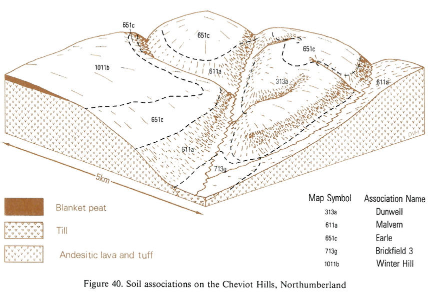
| B10 Cheviot Hills No..> | 2013-04-02 13:44 | 90K | ||
| B15 Wickham 5.PNG | 2012-12-05 14:39 | 164K | ||
| B15 North Oxfordshir..> | 2012-12-05 14:39 | 428K | ||
| B15 Western Weald.PNG | 2012-12-05 14:38 | 554K | ||
| B15 North Kent.PNG | 2012-12-05 14:37 | 365K | ||
| B15 Scarp on the Ber..> | 2012-12-05 14:35 | 522K | ||
| B15 Ragdale and Ashl..> | 2012-12-05 14:34 | 385K | ||
| B15 North Buckingham..> | 2012-12-05 14:33 | 536K | ||
| B15 Romney Marsh.PNG | 2012-12-05 14:30 | 410K | ||
| B15 Upper Thames Val..> | 2012-12-05 14:29 | 411K | ||
| B15 West Sussex Coas..> | 2012-12-05 14:11 | 502K | ||
| B15 Lower Greensand ..> | 2012-12-05 13:50 | 463K | ||
| B15 Evenlode valley.PNG | 2012-12-05 13:49 | 526K | ||
| B15 Curtisden.PNG | 2012-12-05 13:48 | 175K | ||
| B15 High Weald.PNG | 2012-12-05 13:48 | 598K | ||
| B15 East Hampshire C..> | 2012-12-05 13:47 | 395K | ||
| B15 Northern New For..> | 2012-12-05 13:46 | 516K | ||
| B15 North Downs in K..> | 2012-12-05 13:46 | 530K | ||
| B15 Andover 1.PNG | 2012-12-05 13:45 | 175K | ||
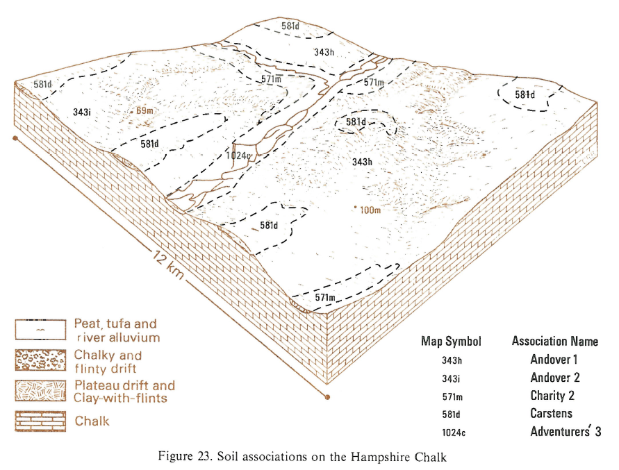
| B15 Hampshire Chalk.PNG | 2012-12-05 13:45 | 546K | ||
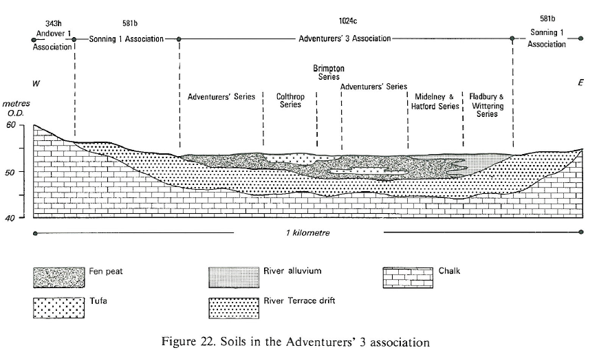
| B15 Adventurers 3.PNG | 2012-12-05 13:44 | 218K | ||
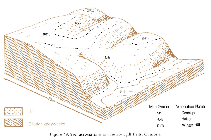
| B10 Howgill Fells Cu..> | 2012-12-05 12:10 | 474K | ||
| B10 Cheviot Hills No..> | 2012-12-05 12:09 | 451K | ||
| B10 Ingleton North Y..> | 2012-12-05 12:08 | 518K | ||
| B10 Cleveland Hills ..> | 2012-12-05 12:07 | 356K | ||
| B10 Lyth Valley Cumb..> | 2012-12-05 12:07 | 284K | ||
| B10 Penrith Cumbria.PNG | 2012-12-05 12:05 | 412K | ||
| B10 Alston Cumbria.PNG | 2012-12-05 12:04 | 295K | ||
| B10 Stockbridge Sout..> | 2012-12-05 12:03 | 344K | ||
| B10 Cross Fell Cumbr..> | 2012-12-05 12:03 | 439K | ||
| B10 Pocklington Humb..> | 2012-12-05 12:02 | 337K | ||
| B10 North York Moors..> | 2012-12-05 12:01 | 386K | ||
| B10 Scunthorpe Humbe..> | 2012-12-05 12:01 | 405K | ||
| B13 Tendring peninsu..> | 2012-11-15 10:10 | 582K | ||
| B13 Cambridge chalkl..> | 2012-11-15 10:09 | 634K | ||
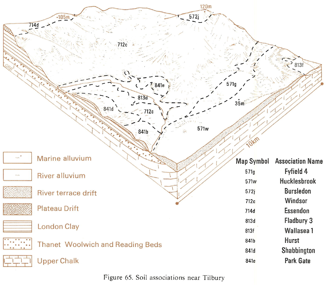
| B13 Tilbury.PNG | 2012-11-15 10:08 | 917K | ||
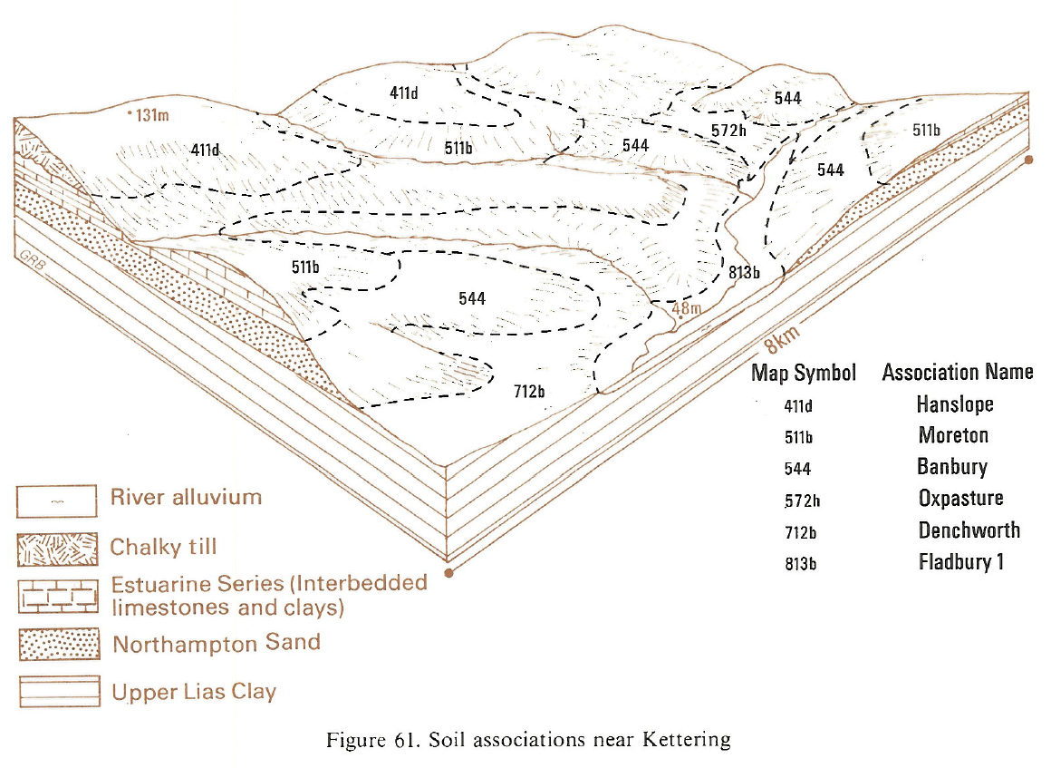
| B13 Kettering.PNG | 2012-11-15 10:07 | 796K | ||
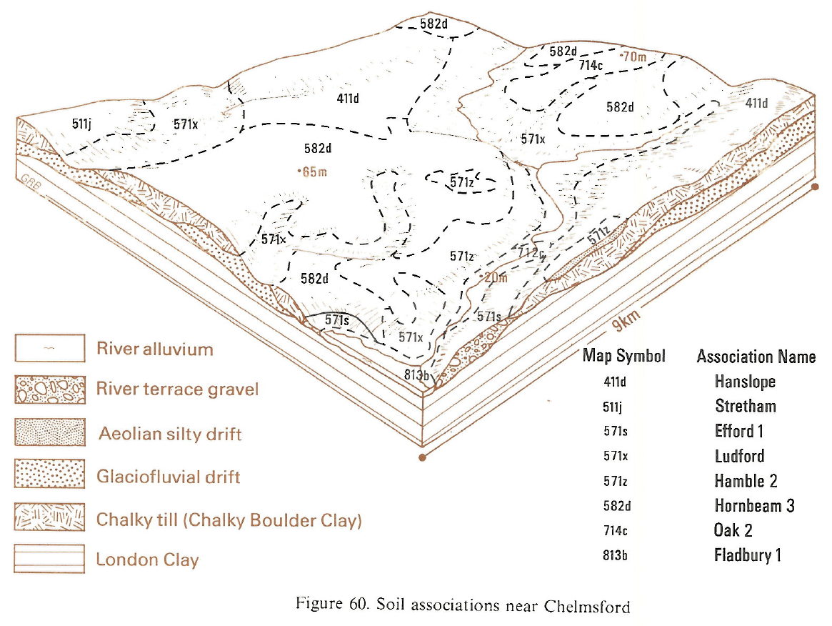
| B13 Chelmsford.PNG | 2012-11-15 10:07 | 833K | ||
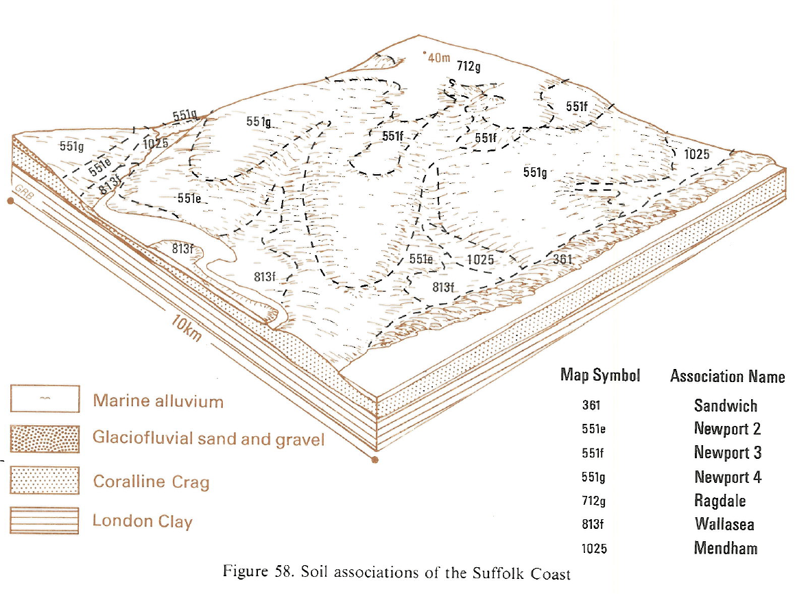
| B13 Suffolk Coast.PNG | 2012-11-15 10:06 | 905K | ||
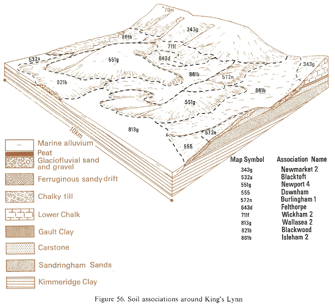
| B13 Kings Lynn.PNG | 2012-11-15 10:06 | 1.0M | ||
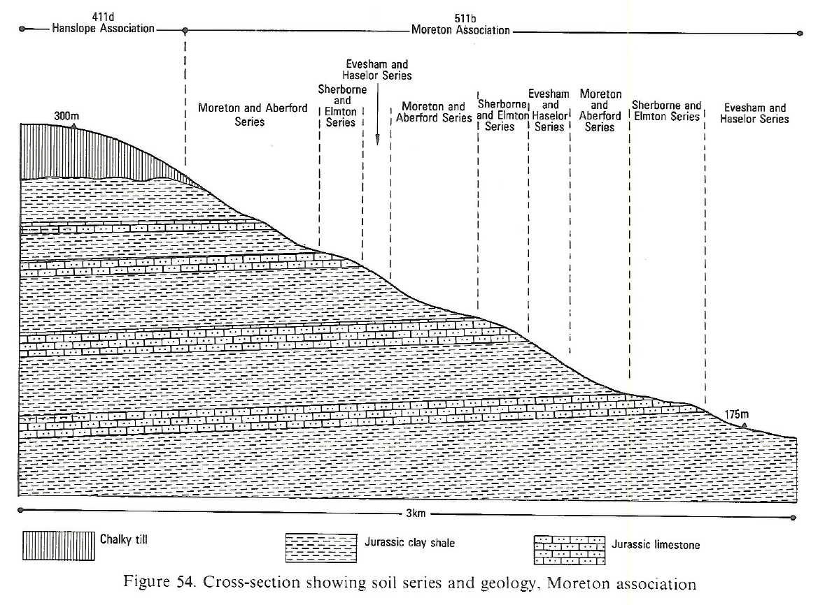
| B13 Moreton Associat..> | 2012-11-15 10:05 | 768K | ||
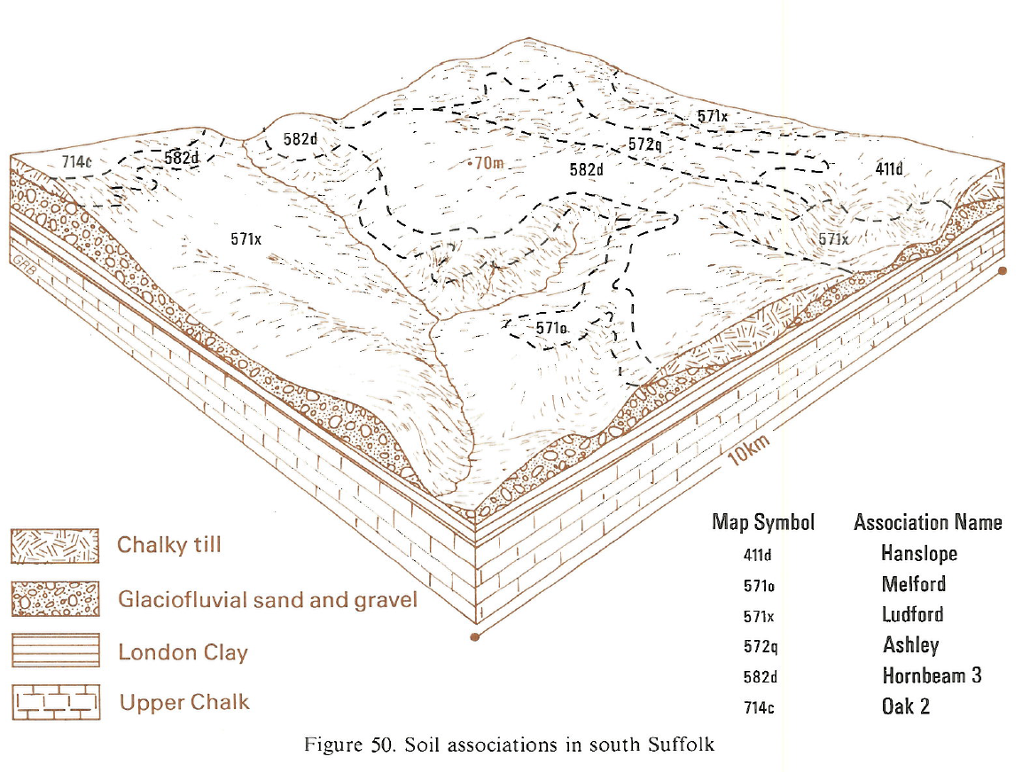
| B13 South Suffolk.PNG | 2012-11-15 10:04 | 960K | ||
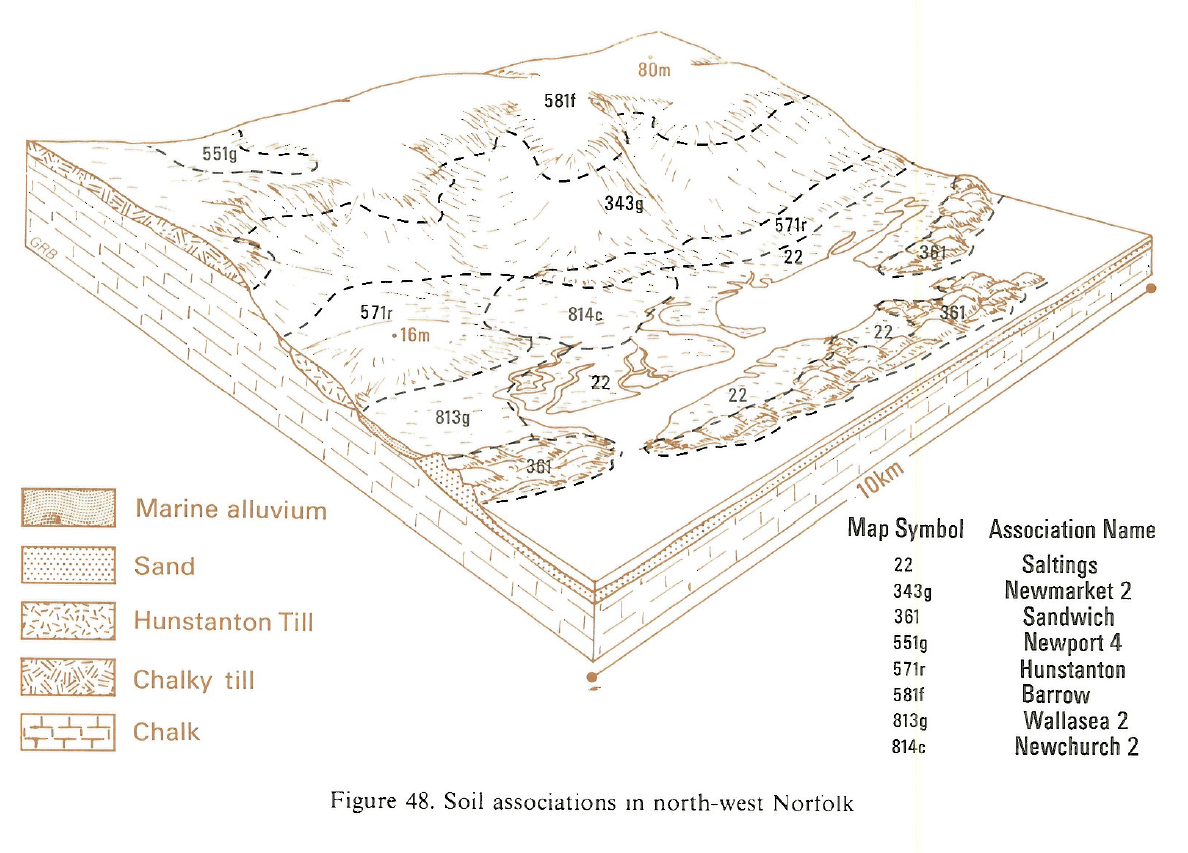
| B13 North-West Norfo..> | 2012-11-15 10:03 | 867K | ||
| B13 South Lincolnshi..> | 2012-11-15 10:03 | 929K | ||
| B13 Norfolk Broads.PNG | 2012-11-15 10:02 | 1.1M | ||
| B13 Woburn.PNG | 2012-11-14 15:39 | 161K | ||
| B13 Lincoln.PNG | 2012-11-14 15:38 | 192K | ||
| B13 Western Bedfords..> | 2012-11-14 15:38 | 192K | ||
| B13 Central Fenlands..> | 2012-11-14 15:37 | 226K | ||
| B13 South Norfolk.PNG | 2012-11-14 15:36 | 178K | ||
| B13 Chilterns.PNG | 2012-11-14 15:36 | 162K | ||
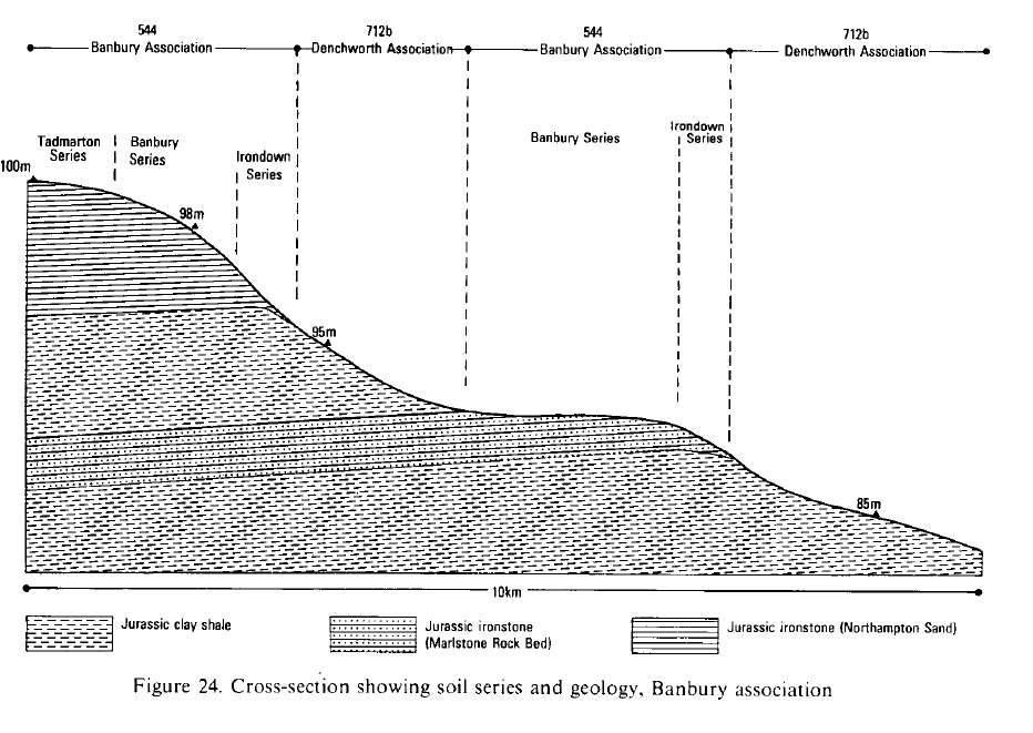
| B13 Banbury Associat..> | 2012-11-14 15:35 | 62K | ||
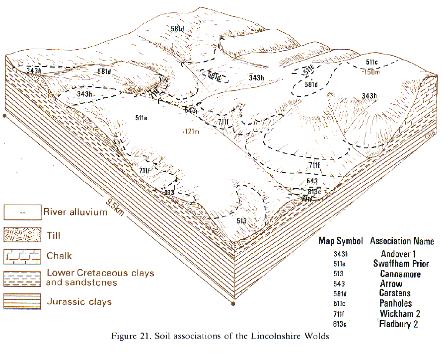
| B13 Lincolnshire Wol..> | 2012-11-14 15:35 | 199K | ||
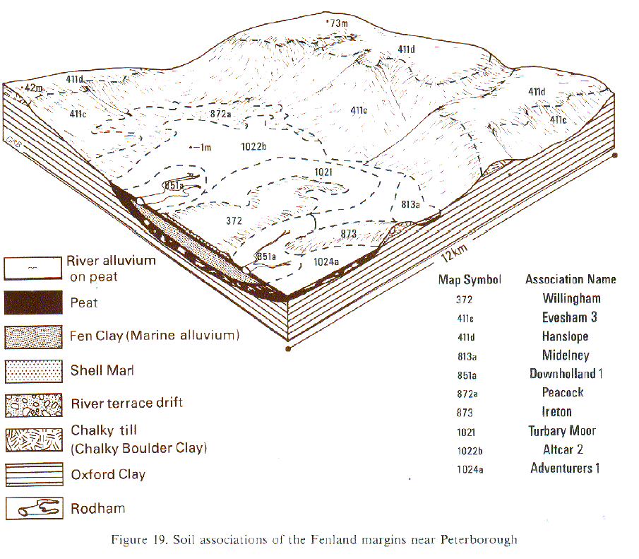
| B13 Fenland Margins ..> | 2012-11-14 15:34 | 187K | ||
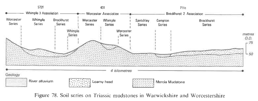
| B12 Warwickshire and..> | 2012-11-14 14:43 | 114K | ||
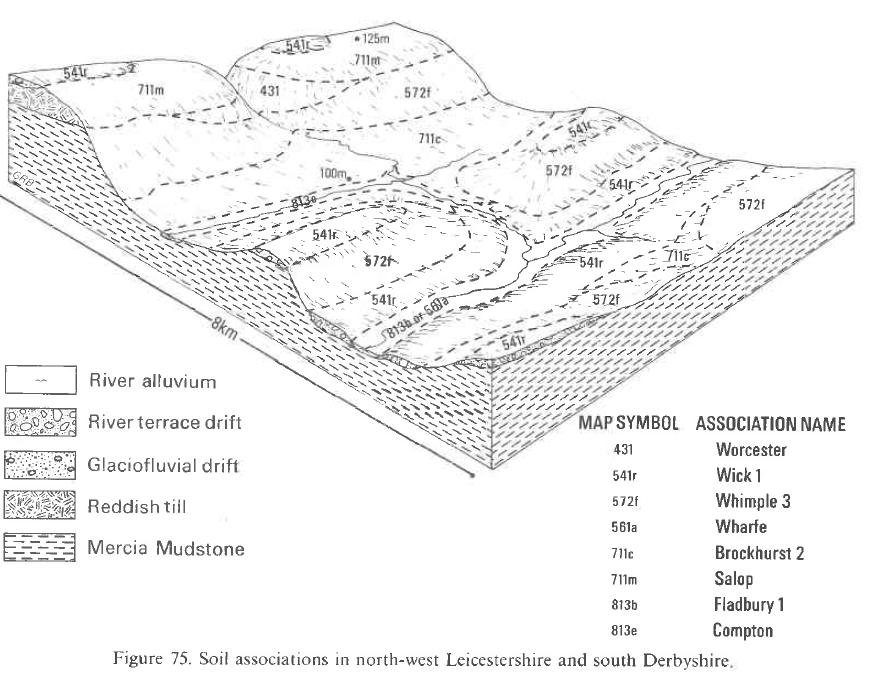
| B12 north-west Leice..> | 2012-11-14 14:42 | 211K | ||
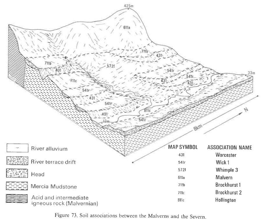
| B12 Between the Malv..> | 2012-11-14 14:41 | 291K | ||
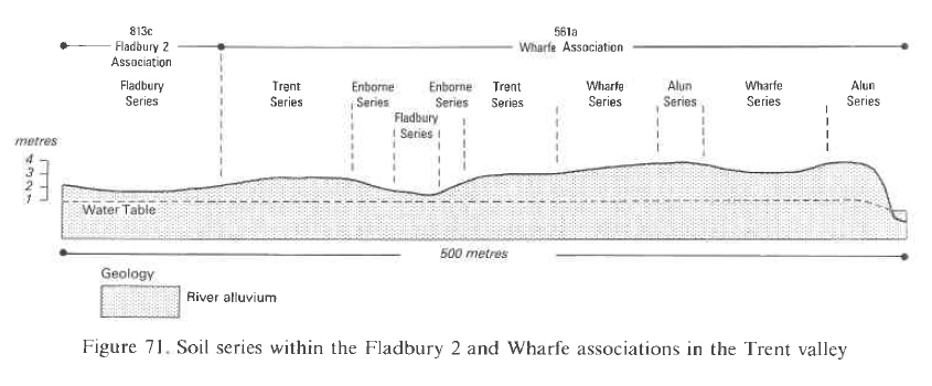
| B12 Fladbury 2 and W..> | 2012-11-14 14:40 | 109K | ||
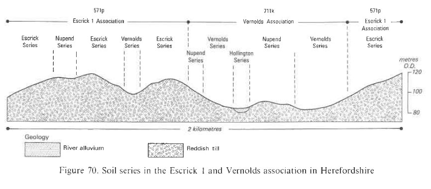
| B12 Escrick 1 and Ve..> | 2012-11-14 14:40 | 129K | ||
| B12 mid-Cheshire rid..> | 2012-11-14 14:39 | 266K | ||
| B12 Derwent valley D..> | 2012-11-14 14:38 | 283K | ||
| B12 Tilton on the Hi..> | 2012-11-14 14:37 | 266K | ||
| B12 Wenlock Edge, Sh..> | 2012-11-14 14:36 | 275K | ||
| B12 Carboniferous Li..> | 2012-11-14 14:36 | 319K | ||
| B12 Cannock Chase an..> | 2012-11-14 14:35 | 345K | ||
| B12 Bredon Hill to t..> | 2012-11-14 14:34 | 273K | ||
| B12 Wye Valley near ..> | 2012-11-14 14:33 | 325K | ||
| B12 Loughborough.PNG | 2012-11-14 14:32 | 314K | ||
| B12 Cuckney Associat..> | 2012-11-14 14:31 | 163K | ||
| B12 Cheshire Plain.PNG | 2012-11-14 14:31 | 160K | ||
| B12 Charnwood Forest..> | 2012-11-14 14:30 | 143K | ||
| B12 Bromsgrove Assoc..> | 2012-11-14 14:30 | 170K | ||
| B12 The Roaches Staf..> | 2012-11-14 14:29 | 323K | ||
| B12 Church Stretton ..> | 2012-11-14 14:28 | 250K | ||
| B12 Coal Measures in..> | 2012-11-14 14:27 | 167K | ||
| B12 Formby and South..> | 2012-11-14 14:26 | 204K | ||
| B11 Wilcocks 2 Assoc..> | 2012-11-12 16:42 | 82K | ||
| B11 Black Mountain D..> | 2012-11-12 16:41 | 84K | ||
| B11 Teme Association..> | 2012-11-12 16:41 | 79K | ||
| B11 Sandwich Associa..> | 2012-11-12 16:40 | 94K | ||
| B11 Abergele.PNG | 2012-11-12 16:39 | 110K | ||
| B11 Revidge Associat..> | 2012-11-12 16:38 | 54K | ||
| B11 Ordovician rocks..> | 2012-11-12 16:38 | 115K | ||
| B11 North East of Wr..> | 2012-11-12 16:37 | 106K | ||
| B11 Preseli Hills so..> | 2012-11-12 16:37 | 126K | ||
| B11 Honeyborough and..> | 2012-11-12 16:36 | 90K | ||
| B11 Manod Associatio..> | 2012-11-12 16:35 | 103K | ||
| B11 Brecon Beacons.PNG | 2012-11-12 16:34 | 82K | ||
| B11 Preseli Hills.PNG | 2012-11-12 16:34 | 131K | ||
| B11 Palaeozoic mudst..> | 2012-11-12 16:33 | 73K | ||
| B11 Pennant sandston..> | 2012-11-12 16:33 | 120K | ||
| B11 South West Dyfed..> | 2012-11-12 16:31 | 116K | ||
| B11 East Keswick 3 a..> | 2012-11-12 16:31 | 100K | ||
| B11 Devonian rocks a..> | 2012-11-12 16:30 | 114K | ||
| B11 Ordovician rocks..> | 2012-11-12 16:29 | 110K | ||
| B11 East of Snowdon.PNG | 2012-11-12 16:28 | 186K | ||
| B14 Permo-Triassic r..> | 2012-11-08 16:54 | 501K | ||
| B14 Chalk scarp and ..> | 2012-11-08 16:54 | 420K | ||
| B14 Chalk in North W..> | 2012-11-08 16:31 | 434K | ||
| B14 641b SOLLOM.PNG | 2012-11-08 16:30 | 545K | ||
| B14 East Dorset.PNG | 2012-11-08 16:29 | 428K | ||
| B14 Dartmoor granite..> | 2012-11-08 16:28 | 478K | ||
| B14 Exmoor.PNG | 2012-11-08 16:26 | 1.0M | ||
| B14 Thames Valley ne..> | 2012-11-08 16:26 | 1.0M | ||
| B14 Carboniferous ro..> | 2012-11-08 16:24 | 1.1M | ||
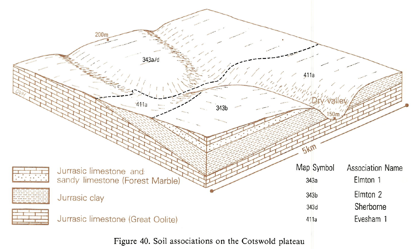
| B14 Cotswold Plateau..> | 2012-11-08 16:22 | 1.0M | ||
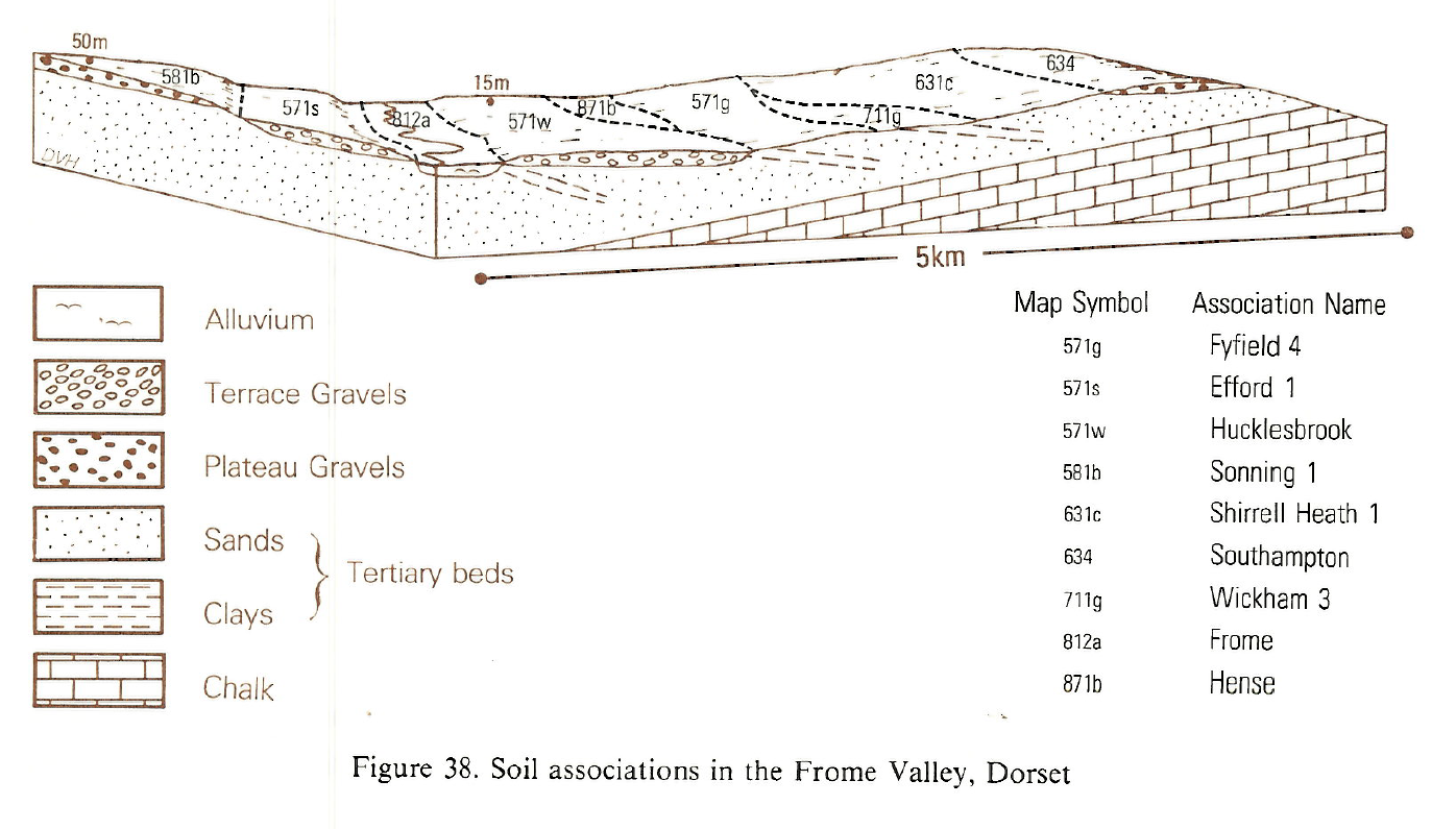
| B14 Frome Valley Dor..> | 2012-11-08 16:21 | 667K | ||
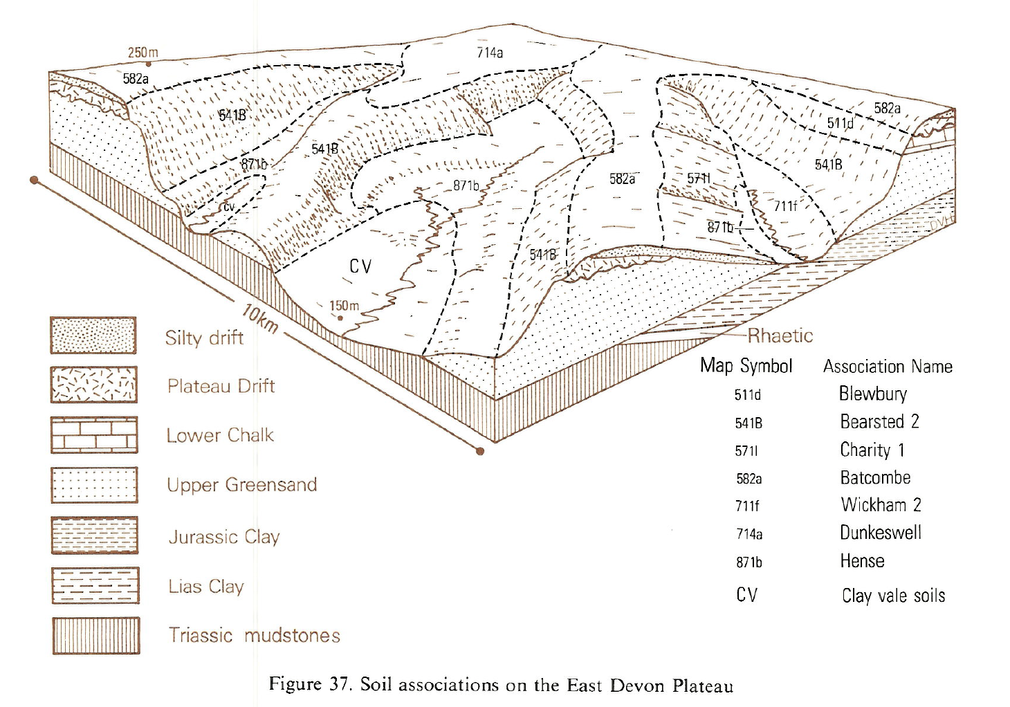
| B14 East Devon Plate..> | 2012-11-08 16:21 | 1.2M | ||
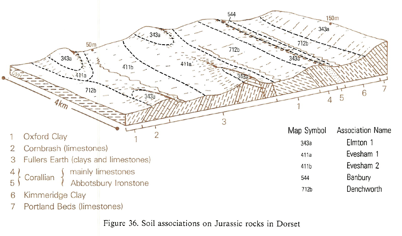
| B14 Jurassic rocks i..> | 2012-11-08 16:19 | 796K | ||
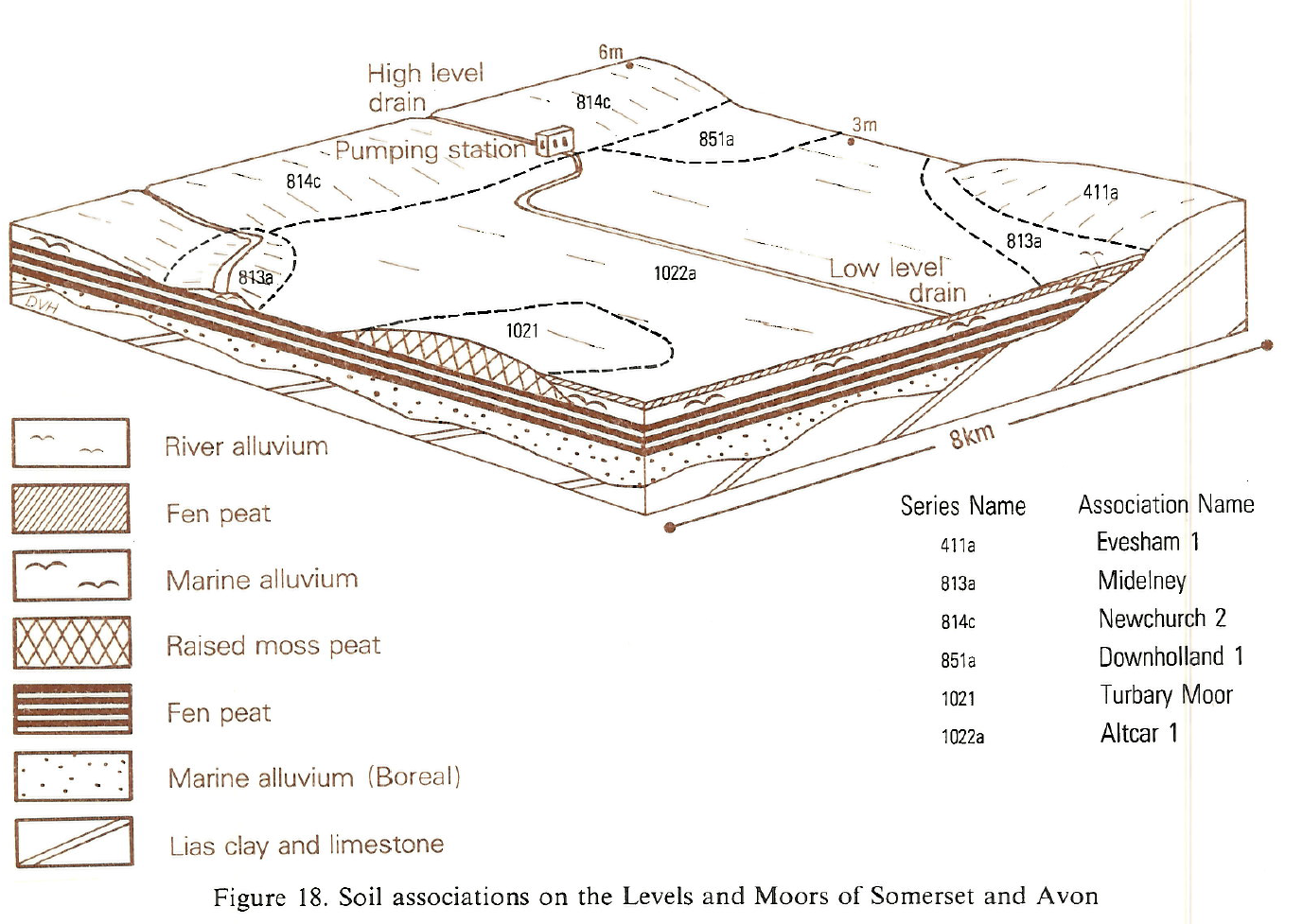
| B14 Levels and Moors..> | 2012-11-08 16:17 | 951K | ||
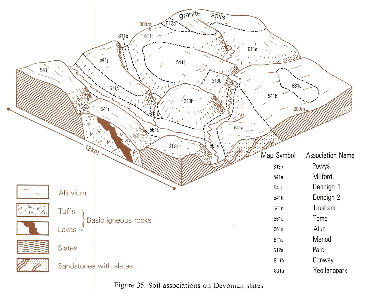
| B14 Devonian Slates.PNG | 2012-11-08 16:15 | 908K | ||
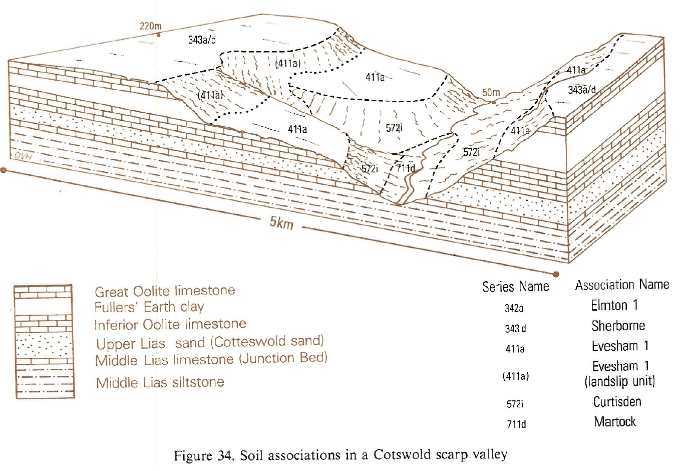
| B14 Cotswold scarp v..> | 2012-11-08 16:14 | 1.1M | ||
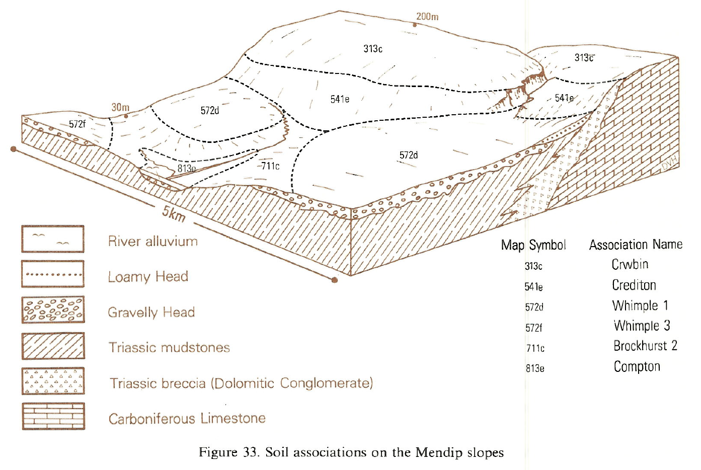
| B14 Mendip slopes.PNG | 2012-11-08 16:12 | 1.0M | ||
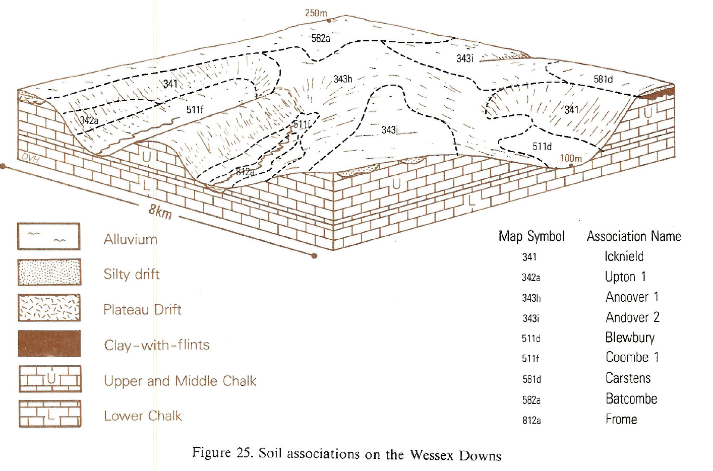
| B14 Wessex Downs.PNG | 2012-11-08 16:07 | 968K | ||
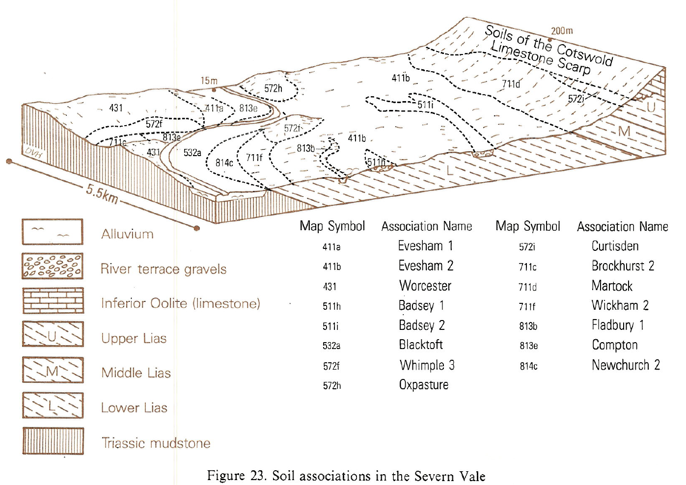
| B14 Severn Vale.PNG | 2012-11-08 16:06 | 941K | ||
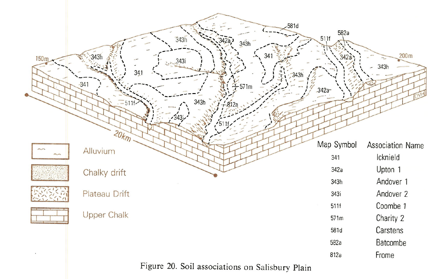
| B14 Salisbury Plain.PNG | 2012-11-08 16:04 | 922K | ||